


Geographic Information System
Описание на Geographic Information System
Приложението е пълен безплатен наръчник на Geo Informatics System, който обхваща важни всички теми с подробни бележки, диаграми, уравнения, формули и материал от курса.
Това приложение има 100 теми с подробни бележки, диаграми, уравнения, формули и материал от курса, темите са изброени в 5 глави. Приложението е задължително за всички студенти по инженерни науки
Изтеглете приложението като референтен материал и цифрова книга за граждански и други инженерни програми и курсове.
Приложението е предназначено за бързо учене, ревизии, справки по време на изпити и интервюта.
Това приложение обхваща повечето свързани теми и подробно обяснение с всички основни теми.
Някои от темите, обхванати в това приложение за географска информационна система, са:
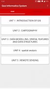
1. ВЪВЕЖДАНЕ НА ГИС
2. ГИС към геоизчисление
3. Технологично улеснение
4. ОСНОВНА ФУНКЦИОНАЛНОСТ НА ГИС
5. СИСТЕМНА ДЕФИНИЦИЯ НА ГИС
6. ГИС науката и възходът на геоинформационното инженерство
7. ГИС НАУКА ДА СЛЕДВАТЕ
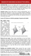
8. ВЪПРОСИ НА НАУКАТА КАТО СЕЛЕКТИВНО ГРУПИРАНЕ НА АСПЕКТИ
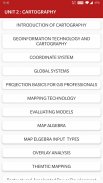
9. ВЪВЕЖДАНЕ НА КАРТОГРАФИЯТА
10. ГЕОИНФОРМАЦИОННИ ТЕХНОЛОГИИ И КАРТОГРАФИЯ
11. КООРДИНАТНА СИСТЕМА
12. ГЛОБАЛНИ СИСТЕМИ
13. ОСНОВИ НА ПРОЕКЦИЯТА ЗА ГИС ПРОФЕСИОНАЛИСТИ
14. МАЩАБ НА КАРТАТА
15. КАРТА ПРОЕКЦИЯ
16. ГЕОМЕТРИЧНО ПРЕОБРАЗУВАНЕ
17. ВЕКТОРНИ И РАСТОРНИ ДАННИ
18. ПРОСТРАНСТВЕН ФЕНОМЕН НА ГИС
19. ФУНКЦИЯ ЗА ПРОСТРАНСТВЕНИ ДАННИ
20. ТЕХНОЛОГИИ ЗА СЪБИРАНЕ НА ДАННИ
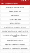
21. ДИСТАНЦИОННО ЗАПАЗВАНЕ
22. ПРОУЧВАНЕ НА ТЕМЕНТА
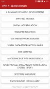
23. Ролята и същността на моделите на околната среда
24. КОНТЕКСТ НА МОДЕЛИРАНЕ НА ОКОЛНАТА СРЕДА
25. РЕЗЮМЕ НА РАЗРАБОТКАТА НА МОДЕЛА
26. ПРИЛАГАНЕ НА МОДЕЛИ
27. МОДЕЛИРАНЕ НА СВЛАЧИЩА
28. МОДЕЛИРАНЕ НА ТОПОГРАФИЯ
29. ТИПОЛОГИЯ НА МОДЕЛИТЕ
30. ПОДХОДИ КЪМ МОДЕЛИРАНЕ
31. ПРЕДСТАВЯНЕ И ИЗЧИСЛЯВАНЕ НА ГЕОГРАФСКАТА ДИНАМИКА
32. ВРЕМЕННО МОДЕЛИРАНЕ
33. ТЕМПОРАЛНА ГИС
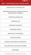
34. КОНЦЕПЦИИ ЗА БАЗА ДАННИ
35. ПРОЕКТИРАНЕ НА БАЗА ДАННИ
36. ТЕХНИКИ ЗА ВЪВЕЖДАНЕ НА ДАННИ
37. КОДИРАНЕ НА ДАННИ
38. СИСТЕМА ЗА ГЛОБАЛНО ПОЗИЦИОНИРАНЕ (GPS)
39. СРАВНЕНИЕ НА КОДИРАНЕ И ДЕКОДИРАНЕ
40. Оформление на КАРТА
41. ЕЛЕМЕНТИ ЗА Оформление на картата
42. ПОПЪЛНЯВАНЕ НА КАРТИ И ПОСЛЕДОВАТЕЛИ
43. ТЕХНОЛОГИИ ЗА ПОСЛЕДОВАНИЕ
44. ТЕХНОЛОГИЯ ЗА КАРТИРАНЕ
45. ОЦЕНЯВАНЕ НА МОДЕЛИ
46. АЛГЕБРА НА КАРТАТА
47. ВИДОВЕ ВХОД ЗА КАРТА ELGEBRA
48. АНАЛИЗ НА НАСЛАГАНЕ
49. ВЕКТОРНО И РАСТЕРНО НАСЛАГВАНЕ
50. МОДЕЛИРАНЕ НА TARAIN
51. ПРОСТРАНСТВЕНА ИНТЕРПОЛАЦИЯ
52. ТРАНСФЕРНА ФУНКЦИЯ
53. ГИС И ИЗКУСТВЕНИ НЕРВНИ МРЕЖИ
54. МРЕЖИ
55. ГИС И МРЕЖОВ АНАЛИЗ
56. ПРИЛОЖЕНИЯ НА ГИС за водни ресурси
57. ХИДРОЛОГИЧНО МОДЕЛИРАНЕ
58. ГИС И ОБЩЕСТВО
59. ГИС И ТРАНСПОРТ
60. ОЦЕНКА НА ГЕОТЕХНИЧЕСКИТЕ ХАРАКТЕРИСТИКИ, БАЗАНА НА ГИС
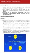
61. ГЕОТЕХНИЧЕСКИ СЪОРЪЖЕНИЯ
62. ГЕНЕРИЛАЦИЯ НА ПРОСТРАНСТВИТЕ ДАННИ В ГИС
63. УЕБ КАРТИРАНЕ
64. ЗНАЧЕНИЕ НА УЕБ БАЗИРАНИЯ ДИЗАЙН
65. АНАЛИЗ НА ВЪЗДЕЙСТВИЕТО НА ОКОЛНАТА СРЕДА
66. КАРТА СЛУЖБА
67. СЪЗДАВАНЕ И РАЗВИТИЕ НА СИСТЕМИ ЗА МОНИТОРИНГ НА ЕМВ
68. ГИС В УПРАВЛЕНИЕТО НА КОМУНАЛНАТА ИНФОРМАЦИЯ
69. ТЕМАТИЧНО КАРТИРАНЕ
70. Преструктурирано-ускорено развитие на електроенергията и програмирани реформи
71. ГИС В УПРАВЛЕНИЕТО НА КОМУНАЛНАТА ИНФОРМАЦИЯ
72. ТЕМАТИЧНО КАРТИРАНЕ
73. Преструктурирано-ускорено развитие и програмирани реформи
74. ФОТОГРАМЕТРИЯ
75. МОБИЛНО КАРТИРАНЕ
Всички теми не са изброени поради ограничения на знаците.
Характеристика :
* Глава мъдър пълни теми
* Богато оформление на потребителския интерфейс
* Удобен режим на четене
* Важни изпитни теми
* Много прост потребителски интерфейс
* Покрийте повечето теми
* С едно щракване получите свързани All Book
* Съдържание, оптимизирано за мобилни устройства
* Мобилни оптимизирани изображения
Всяка тема е пълна с диаграми, уравнения и други форми на графично представяне за по-добро учене и бързо разбиране.
Това приложение ще бъде полезно за бърза справка. Ревизията на всички концепции може да бъде завършена в рамките на няколко часа с помощта на това приложение.
Вместо да ни давате по-ниска оценка, моля, изпратете ни вашите запитвания, проблеми и ни дайте ценни оценки и предложения, за да можем да го разгледаме за бъдещи актуализации. Ще се радваме да ги решим вместо вас.
Geographic Information System - Version 11.0
(10-09-2024)Geographic Information System - APK информация
APK версия: 11.0Пакет: engg.hub.geoinformatics.systemLatest Version of Geographic Information System
Други версии


Apps in the same category

You may also like...


